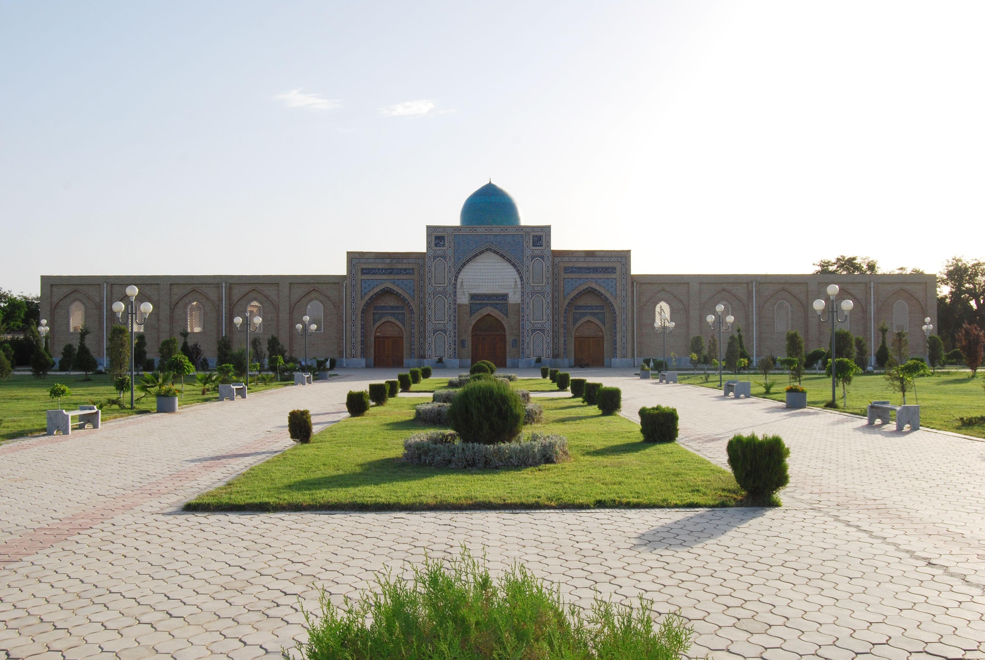
More than half of Uzbekistan is desert, and each one is different: the red sands and saxaul of the Kyzylkum, the white salt desert that replaced the Aral Sea, the limestone tableland of the Ustyurt with its cliffs and ancient hunting arrows. Where they are, what grows and lives there, and a comparison of the yurt camps at Aydarkul, Ayaz-Kala and the Aral shore.
Facts, prices and schedules checked on November 11, 2026
The Silk Road cities exist because of the deserts, not in spite of them. Bukhara, Khiva and Samarkand are oases, and the caravans that made them rich spent weeks crossing the sand between one and the next. A traveller who sees only the cities sees the stage without the set. Yet the deserts of Uzbekistan are easy to reach, and the night spent in a felt yurt between Samarkand and Bukhara, or on the edge of the dry Aral seabed, is the one most of our guests describe first when they get home.
The country has five deserts: the Kyzylkum, which covers most of the centre; the Aralkum, the youngest desert on earth; the Ustyurt plateau in the far west; and the smaller Sundukli sands and the former Hungry Steppe. Most visitors choose between three yurt camps, which differ in cost and in the best time to go.
Kyzylkum: the red sands between two rivers
The Kyzylkum, the Red Sands, fills the space between the Amu Darya and the Syr Darya, roughly 300,000 km² shared with Kazakhstan and Turkmenistan and most of it in Uzbekistan. It is not a sea of dunes. Much of it is flat clay plain and takyr, cracked and pale, with ridges of reddish sand, low rocky hills that were once mountains, and forests of saxaul, the leafless grey shrub whose roots hold the desert in place and whose wood burns hotter than coal. After a wet spring the whole thing turns green for three weeks and the sand blooms with tulips and poppies.
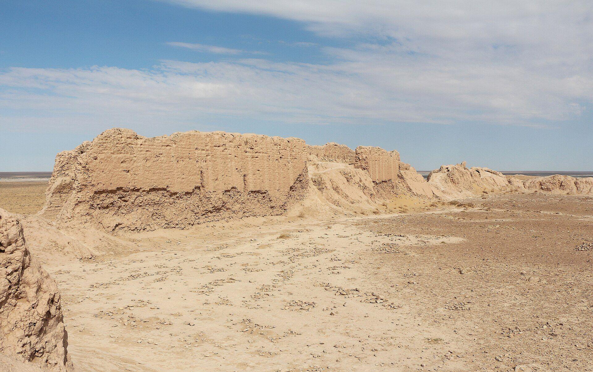
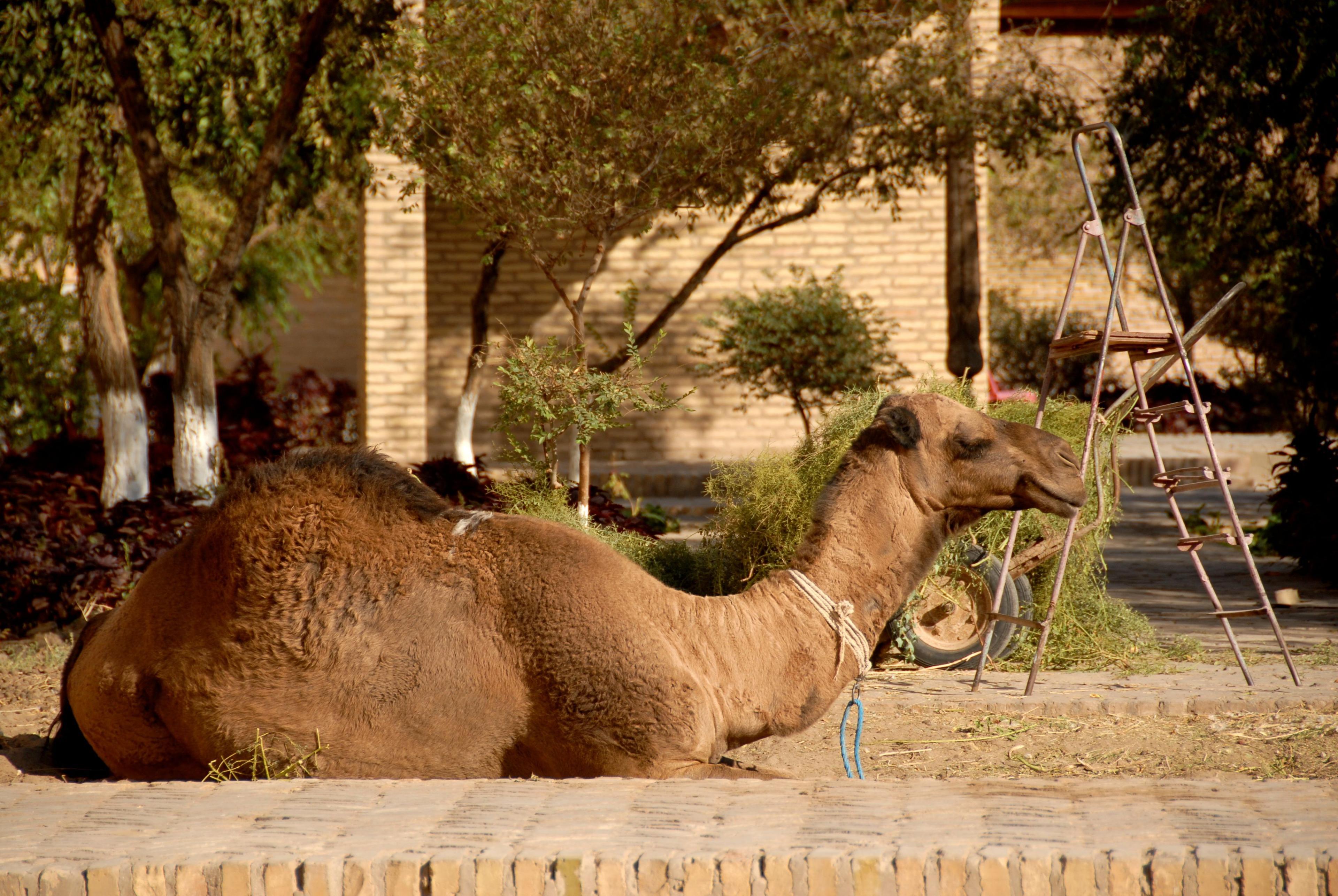
The animals are there if you are patient: goitered gazelles, which the Uzbeks call jeyran, desert foxes and wolves, tortoises by the hundred in April, monitor lizards up to a metre and a half long, jerboas at night and eagles by day. The Jeyran Ecocentre near Bukhara, a fenced reserve breeding gazelles, kulans and Przewalski's horses, is the surest place to see them. Camel herders in the Navoi region still milk their animals, and a glass of shubat, fermented camel milk, is offered to guests with a straight face. Almost everything a traveller does in the Kyzylkum happens on its edges: the desert fortresses of Khorezm on its western rim, the Nurata mountains and Lake Aydarkul on its eastern, and the road from Bukhara to Khiva straight across the middle.

Aralkum: a desert born in our lifetime
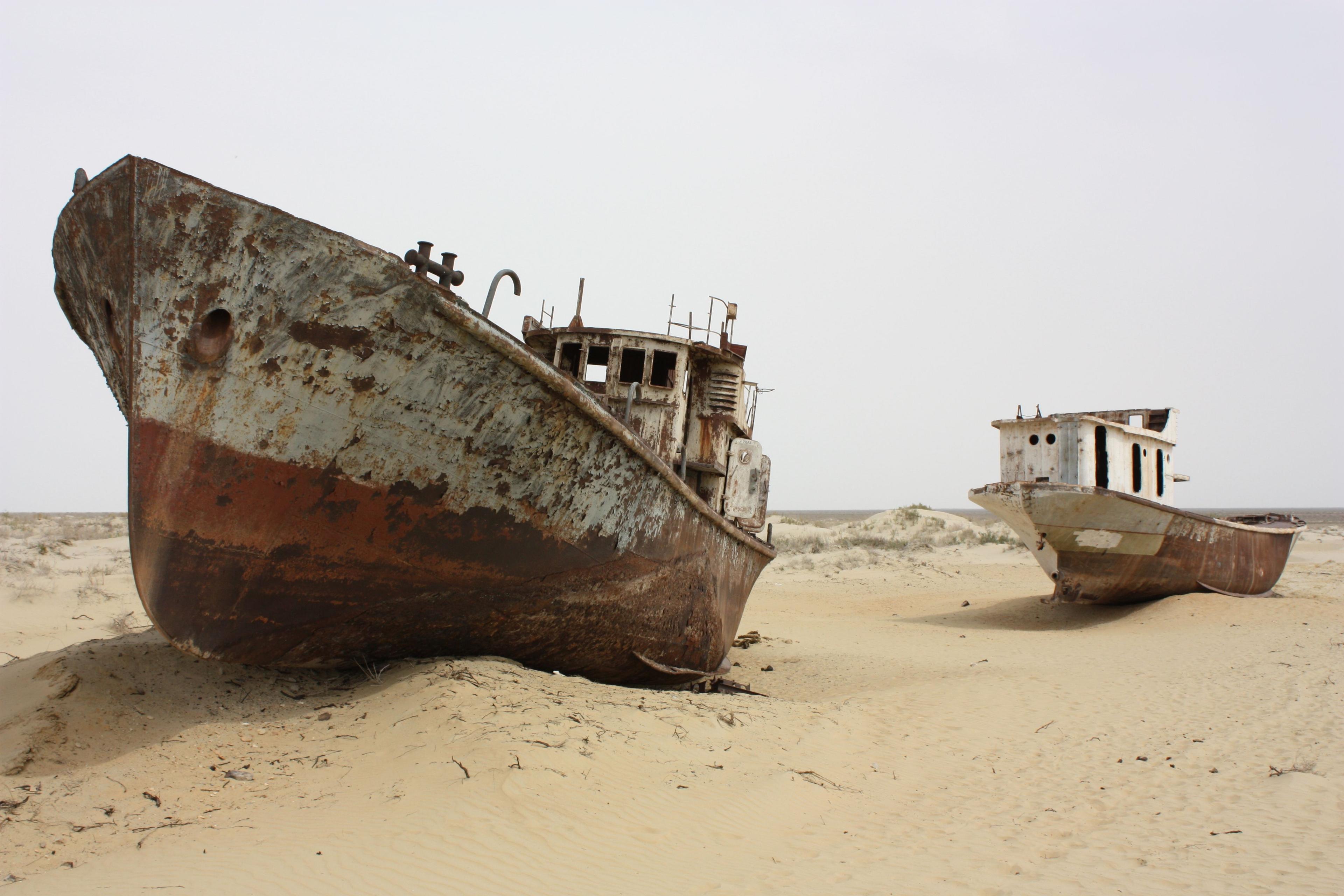
Where the Kyzylkum meets the former Aral Sea, the ground changes colour. The Aralkum is the seabed exposed since the 1960s, when the rivers that fed the Aral were diverted to irrigation; the sea lost nine-tenths of its volume and the shore retreated more than 100 km from Muynak. What was left is a white and grey plain of salt, sand and shell, crossed by the ribs of dead boats, and it is growing. Older sources give its area as 38,000 km²; recent reporting puts it above 60,000 km². Wind lifts an estimated 100 million tonnes of salt and dust from it each year, which is why the planting of saxaul on the dry bed has become one of the largest afforestation efforts in Asia: Uzbekistan reports protective planting across some two million hectares between 2018 and 2025, and UNDP's Green Aral Sea project adds tens of thousands of seedlings each spring.
For a traveller the Aralkum is a landscape of absence. The drive from Muynak to the present shore crosses it in three to four hours of track, past gas installations, salt pans that look like snow and the occasional saxaul plantation in neat rows. Part of it is now the Aralkum National Park. At the end is water again, a long blue basin under the Ustyurt cliffs, and a yurt camp. Our Aral Sea guide has the full two-day itinerary.
Ustyurt: the plateau of cliffs and arrows
West of the Aral the land climbs a single step onto the Ustyurt plateau, a limestone tableland of around 200,000 km² shared with Kazakhstan and Turkmenistan. Its edges, called chinks, are cliffs of 200 m and more, carved into bays and white, pink and ochre terraces; the rock was the floor of an ocean and is full of shells. From the top you look down on the Aralkum and, on a clear morning, the surviving sea. The surface is a clay-and-gravel desert with almost no water and a wind that does not stop, which is why the Soviet-era checkpoints and the few remaining saiga antelope have it mostly to themselves.
The plateau's strangest feature was unknown until 1986, when the Karakalpak archaeologist Vadim Yagodin spotted on aerial photographs a chain of arrow-shaped stone enclosures, some 900 m long, laid along the old shoreline. Around fifty are now known. They are read as mass hunting traps, into which migrating herds of saiga and kulan were driven; their date is uncertain. They are invisible from the ground, so the reason to come is the landscape itself: sunrise from the cliff edge above Lake Sudochye, where flamingos nest in the reeds below, and the ruins of the Russian fishing station of Urga under the chink. Ustyurt is an expedition rather than an excursion. Allow two or three days from Nukus with a 4x4 and a driver who knows the tracks.

Sundukli and the Hungry Steppe
Two smaller deserts complete the picture. The Sundukli sands lie south of Bukhara towards the Kashkadarya region, a continuation of the Kyzylkum but golden rather than red, with crescent dunes, dry riverbeds and deposits of therapeutic mud that local sanatoriums use; the Bukhara region's salt-and-sand treatment centre draws on the same tradition. Most travellers see Sundukli from the train window between Bukhara and Karshi. The Hungry Steppe, Mirzachul, between the Syr Darya and the Turkestan range, was a waterless plain of some 10,000 km² until Russian and then Soviet canals turned it into cotton fields and orchards from the 1890s onwards. It is no longer a desert at all. What it offers today is the melons and pomegranates of the Syrdarya region, sold from the roadside on the Tashkent–Samarkand highway, which crosses it in an hour.
Where to sleep in a yurt: three camps compared
Uzbekistan's yurt camps are run for travellers rather than by nomads, which is worth knowing in advance. The yurts are genuine felt-on-lattice structures in the Kazakh and Karakalpak style, with carpets, mattresses and quilts; the bathrooms are shared blocks a short walk away; the food is cooked on site; and the evening usually ends with a bonfire and an akyn singing to a dombra. Three camps account for most stays:
- Aydarkul, Kyzylkum. The classic. Several camps stand in the sand near the village of Yangikazgan, about 50 km from Nurata and a half-day from Samarkand or Bukhara, with a short drive or a camel ride to the lake for a swim. Expect 10–20 yurts, four to six beds each, dinner and breakfast, and camels at extra cost. Indicative price around US$40–50 per person with meals, as of 2026. See our Kyzylkum yurt camps page.
- Ayaz-Kala, Khorezm. A camp on a ridge below the two Ayaz-Kala fortresses, 100 km from Khiva and reached on the day of fortress-hopping across Elliq-Kala. The view at dawn, with the mud walls above and the Kyzylkum stretching to the horizon, is the best of the three; facilities are the most basic. Suits one night between Khiva and Nukus.
- Aral shore, Karakalpakstan. Yurts on the Ustyurt cliff or by the water at the end of the Muynak track. This is a remote camp with no road, no phone signal and a generator; it exists for the expedition and the sunrise over the sea. Usually booked as part of a two-day Aral trip from Nukus, with the camp night quoted at around US$40–50 and the whole trip US$300–450 per person depending on group size.
Bring a head torch, a warm layer even in June, earplugs if you share, and no expectation of Wi-Fi. Families are welcome at Aydarkul, where the camels and the swimming carry the day; the Aral camp suits adults and older teenagers.
When to go, how to get there and what it costs
The desert year has two good seasons. April to early June brings flowers, tortoises, bearable days of 25–32 °C and cold nights; September to October brings clear skies, warm water in Aydarkul and the best light. July and August reach 45 °C in the Kyzylkum and are higher still on the Aralkum salt; camps stay open but afternoons are spent lying down. Winter is empty and beautiful, with snow on the dunes some years, but the camps close and the Ustyurt wind is punishing.
Access is by road. The Kyzylkum is crossed by the Bukhara–Khiva highway, now a smooth six to seven hours by car, and by the Bukhara–Urgench railway. Aydarkul is reached from Nurata on paved road; Ayaz-Kala on paved road from Urgench or Khiva; the Aralkum and Ustyurt only by 4x4 from Nukus, Kungrad or Muynak, which has a small airport with occasional flights but is usually a three- to four-hour drive from Nukus. Nothing in the desert needs a permit except the far corners of the Saigachy reserve on the Ustyurt. Costs are modest once transport is arranged: a private car with driver for a desert day runs roughly US$80–150 depending on distance, camel rides a few dollars, yurt nights as above. Carry cash, sunscreen, two litres of water per person per half-day and a scarf for the wind.
Crossing the deserts with TourEast
Several of our routes include a desert night. Edge of the Map is the full expedition: the Khorezm fortresses, a yurt at Ayaz-Kala, Nukus and the Savitsky collection, Muynak, the Aralkum crossing and the sea itself under the Ustyurt cliffs. Plov, Camels and Castles, our family tour, takes the gentler road through Aydarkul with a camel ride, a short drive to the lake and a campfire. Twelve Gates of the Silk Road, the grand tour, spends a night in the Kyzylkum near Aydarkul and crosses the same desert again on the road to Khiva; the Aralkum and the Ustyurt are on Edge of the Map only. If you have a particular interest, whether it is saiga on the Ustyurt, the saxaul plantations, desert botany in April or simply a night under the Milky Way with a good driver and a cook, tell us and we will build the days around it.
Frequently asked questions
Photo gallery
Photo: Bgag / Wikimedia Commons, CC0; NatalieChunina / Wikimedia Commons, CC BY-SA 4.0; svenfischer.fr / Wikimedia Commons, CC BY-SA 3.0; Fulvio Spada from Torino, Italy / Wikimedia Commons, CC BY-SA 2.0